
How to Read a Ship's AIS Signal Without a Maritime License
A practical guide to reading AIS broadcasts: deciphering MMSI numbers, ship types, speeds, headings and destination fields from public marine data.
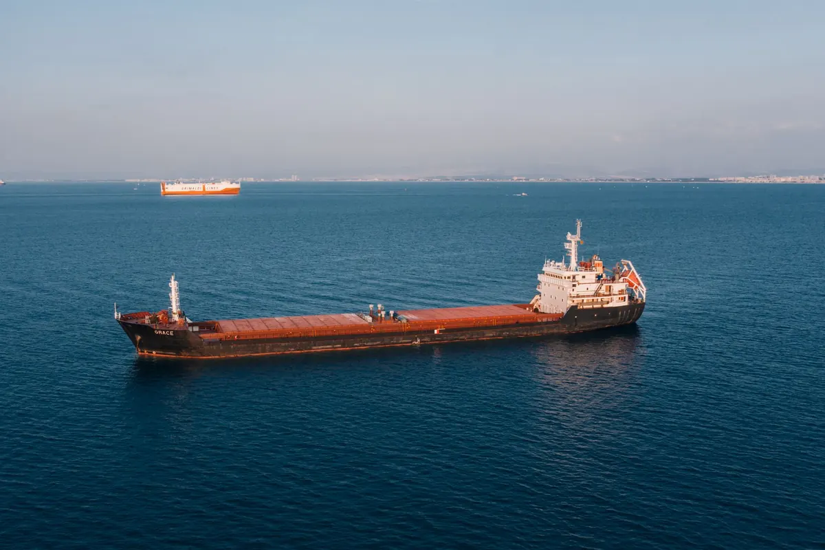
A container ship slides past the breakwater, and a minute later its name appears on your phone next to a small arrow: 11.2 knots, course 248, destination "USNYC." You have never taken a maritime course, never held a radio licence, and yet the sea is suddenly legible. That is the quiet gift of AIS. It is a plain-text conversation between ships, coast stations and satellites, and almost all of it is open for anyone to read. You just need to know which parts to believe.
What AIS actually is
AIS, the Automatic Identification System, is a VHF radio broadcast. Ships transmit short digital packets on two dedicated channels near 162 MHz, and anyone with a receiver within line of sight can listen. Terrestrial shore stations typically hear vessels out to roughly 20 to 40 nautical miles depending on antenna height; satellites catch them farther offshore. Those stations feed websites and apps that display the data on a map.
There are several message types, and knowing them clears up most confusion:
- Types 1, 2 and 3 — position reports: latitude, longitude, speed, course, heading, navigational status.
- Type 5 — static and voyage data: vessel name, call sign, IMO number, dimensions, draught, destination, ETA.
- Types 18 and 19 — the same information from smaller Class B transponders, typically found on yachts and workboats.
- Type 21 — aids to navigation: buoys, beacons and virtual marks.
- Type 24 — a static data report used by Class B units, sometimes carrying only part of a name.
Class A transponders, mandatory on most commercial vessels, report every few seconds while under way and every three minutes at anchor. Class B units report far less often, so a small boat's track can look like a dotted line rather than a ribbon.
Start with the nine digits
Every AIS target carries an MMSI, a nine-digit identity number. The first three digits are the Maritime Identification Digits, or MID, which tell you the flag state the number was issued under. Once you learn a handful, you can read a vessel's registry at a glance:
- 366 — United States
- 477 — Hong Kong
- 538 — Marshall Islands
- 636 — Liberia
- 563 — Singapore
Other prefixes behave differently. Coast stations begin with 00, group ship stations with a single 0, search-and-rescue aircraft with 111, and aids to navigation with 99. When you see a target with a number that does not fit those patterns, you are usually looking at a misconfigured unit. MMSIs get typed in wrong, copied from a previous owner, or duplicated across two vessels. It happens more often than you would expect.
Reading the moving parts
Speed and course are the numbers people stare at first, and they reward a little care.
Speed over ground versus speed through water
The speed shown is over ground, derived from satellite positioning. A ship pushing into a three-knot current may show 9 knots while its own log reads 12. When you compare an AIS speed against a schedule or a tidal atlas, remember the difference.
Course versus heading
Course over ground is the direction the vessel is actually travelling. Heading is where the bow is pointed. On a calm day they match. When they diverge, something is pushing the hull sideways: current, wind, or a tug. A ship with heading 090 and course 102 is crabbing southward. That gap is one of the most useful readings on the screen, and almost nobody outside the industry looks at it.
Navigational status
This small field is often the most revealing. Values include under way using engine, at anchor, moored, restricted manoeuvrability, constrained by draught, not under command and aground. A vessel showing 0.4 knots with status "moored" is simply swinging on a berth; the same reading with status "under way" suggests someone forgot to update the field.
Ship type codes and dimensions
Type is transmitted as a number. The ranges are consistent enough to memorise in an afternoon: 30 is fishing, 31 and 32 are towing, 36 sailing, 37 pleasure craft, 52 tug, 60 through 69 passenger, 70 through 79 cargo, 80 through 89 tanker, and 90 through 99 other. Anything between 1 and 19 is reserved, and 0 means the crew left it blank.
The static message also carries dimensions: bow to stern, and port to starboard, in metres, plus the reported draught. Those figures let you judge whether the ship you are watching can physically fit a lock, a berth or a channel. A 12.5-metre draught vessel is not going to slip quietly into a marina.
The destination field tells you less than you hope
Destination is free text, limited to about twenty characters, typed by a human. It is frequently stale, abbreviated beyond recognition, or cheerfully unhelpful. You will see "FOR ORDERS," "TBN," "US HOU," and port codes that mean something only to the agent who entered them a week ago. ETA has the same problem: it is an estimate made in good faith by someone on a bridge, not a promise.
Treat destination and ETA as a hint about intent, never as a fact about arrival. The position, course and speed tell you what the ship is doing now. The text field tells you what someone hoped would happen days ago.
Where the data goes wrong
AIS is not a security system and was never designed as one. Signals are occasionally spoofed, identities are sometimes cloned, and transponders are switched off in some waters for reasons ranging from equipment failure to deliberate concealment. Satellite and terrestrial feeds also disagree; a vessel may appear in one and vanish from the other for hours.
To get a reliable picture, cross-check. Compare two independent tracking sites. Compare a vessel's reported track against the buoy it just passed. Look for impossible jumps, sudden type changes or two MMSIs sharing one name. If you plan to use AIS data commercially or in any dispute, check the rules that apply in your jurisdiction, since both transmission requirements and public display policies vary by country and flag state.
A short routine worth keeping
Pick one vessel a week. Follow it from berth to open water, noting when speed rises, when status changes, when the destination field updates, and how the gap between heading and course responds as it meets a tidal stream. Do that twenty times and you will read a harbour the way a local reads a street map.
If you want the raw feed rather than a website's rendering, an inexpensive VHF receiver, a simple antenna and free decoding software will put live AIS on your own screen. Position reporting is a broadcast, and in most places listening costs nothing and requires no licence. What it requires is patience, a little vocabulary, and the habit of asking what the numbers would look like if the vessel were doing something other than what its label claims.
Photo: Alexander Bobrov / Pexels